AIPG-TX West Texas Field Trip About to Begin; Weather Looks Good

The Texas Section of the American Institute of Professional Geologists will sponsor a three-day field trip (April 21-23) to Hudspeth and Culberson counties.  The field trip will cover tectonics and structural geology, economic geology, basin formation, and hydrogeology in one of the most geologically complex areas of Trans-Pecos Texas.

The field trip will focus on:

  • the Sierra Blanca laccoliths and the rare-earth elements property under development through a joint venture by USA Rare Earths and Texas Mineral Resources Corporation;
  • Daltile’s talc mining operation at Allamoore;
  • Fluorspar deposits in the Eagle Mountains;
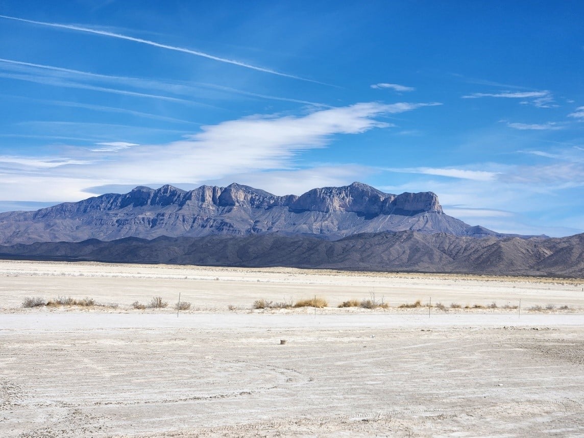
  • An excursion to Eagle Peak (elevation 7300 ft, the highest point in Hudspeth County and the seventh highest in Texas) and an examination of the igneous rocks that make of the core of this impressive mountain range;
  • The northern Carrizo Mountains and the role of the Streeruwitz Thrust Fault in the formation of deformed and metamorphosed rocks of the Carrizo Mountains and the Allamoore talc district;
  • Laramide thrust blocks formed by the Quitman, Red Hills, and Devil Ridge thrust faults;
  • The complex hydrogeology of basins formed during Late Tertiary extensional faulting;
  • And the role of the Diablo Plateau as a stable buttress forming the northernmost boundary of much of the area covered by the field trip.

Leaders of the field trip will be:

Bruce K Darling, PhD, P.G., CPG; Phil Goodell, PhD, UTEP Dept. of Geological Sciences; and Michael Jacobs, MS, P.G.  All have extensive experience in the Trans-Pecos region.

The cost of the field trip will be $1,200 per person.  Transportation, lodging, and lunches are included in the total cost.  For more information, visit the following AIPG webpage for further information to register (Here)

PHOTOS FROM THE FIELD TRIP AREA (Here).

Read More

The AIPG-TX Field Trip to West Texas Still Has Space Available and Open for Registration

Henry M. Wise, P.G., C.P.G. announced today that the AIPG-TX Field Trip to West Texas to begin on April 20th through April 23rd is still open for registration. Click (here).

And there is still space available. Plans are being made to meet-up at an El Paso Airport hotel Thursday evening. This will be confirmed soon.

Previous alerts on the status of the planning, see (here)

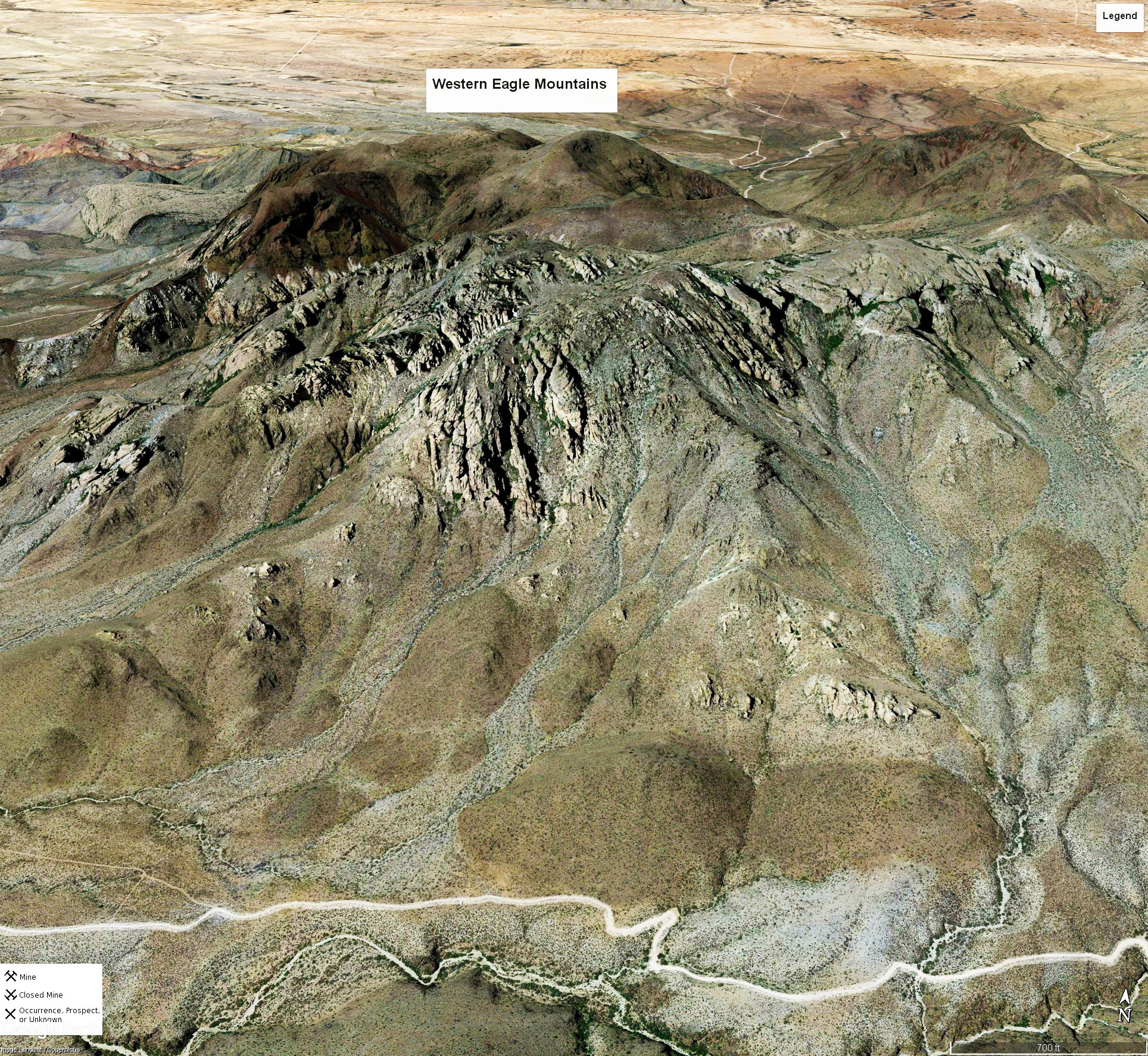
The 2023 AIPG-TX Field Trip to west Texas will cover subjects such as economic geology (gold & silver, and rare earths, beryllium, and uranium, etc.), hydrogeology and structural geology. At the center of attention will be the Eagle Mountains, having one the most scienic views in all of Texas.

The Google Map of the Eagle Mountains area is shown above. A geologic map of the area that you will experience during the field trip is shown (here).  This file is very large ……

Round Top Mountain area will also be observed and the only developing rare-earth/beryllium/uranium mine in Texas will be discussed. For a current summary of the mining company’s current and historical  activities, click (here). For a brief summary of what that mine will produce, see (here). (From Campbell, et al., 2020, see slide #17, click (here)).

A comprehensive Field Trip Guidebook, especially prepared by the AIPG-TX Field Trip team of professional geologists will be provded at no extra cost.

Register now to reserve your place in the West Texas Field Trip.

For question, contact:
Michael D. Campbell, P.G., P.H., C.P.G.
Vice-President – Eastern Texas
mdc@i2mconsulting.com
713-248-1708

Read More

March 2023 AIPG-TX WEBINAR ANNOUNCEMENT – Tuesday, March 21st, at 7.00 p.m.

 Speaker: Dr. Brian Smith

 Principal Hydrogeologist, Barton Springs/Edwards Aquifer Conservation District

 RECHARGE ENHANCEMENT & MULTIPORT WELL MONITORING OF THE EDWARDS AQUIFER

Multiport monitor wells have been used by the Barton Springs/Edwards Aquifer Conservation District (BSEACD) to study complex, multilayer, and stacked aquifers in Hays and Travis Counties, central Texas. Much of the data from water wells that are used for hydrogeological studies are of limited use because of the thickness of the aquifers, vertical variation in hydraulic properties, varying amounts of hydraulic connection between geologic units, and the often-uncertain completion of the wells. To address these concerns, hydrogeologists have employed various methods, such as installation of wells of different depths near one another, multilevel completions in a single borehole, and multiport wells.

The BSEACD has used multiport wells to determine vertical variations in an aquifer and the hydraulic relationships between stacked aquifers. With multiport wells, properties such as hydraulic head, temperature, hydraulic conductivity, and water quality of discrete units within an aquifer, or multiple aquifers, can be determined. The use of multiport wells has shown how portions of the Upper Trinity lithologic units are hydraulically connected to the overlying Edwards lithologic units, and how the Edwards Aquifer is hydraulically isolated from the Middle and Lower Trinity Aquifers. One of these wells installed in southwest Travis County has shown that there is significant depletion of the Middle Trinity Aquifer in that area.

Another multiport well installed in Hays County near Jacob’s Well is helping us understand how groundwater in the porous matrix feeds groundwater to the conduits that discharge water from Jacob’s Well and to the deeper aquifer downgradient east of the spring.

OUR SPEAKER

 Brian Smith has been the Aquifer Science Team Leader and Principal Hydrogeologist at the Barton Springs/Edwards Aquifer Conservation District since 2001. At the District, he has guided the science program to support policy makers in management of the aquifers within the District. Most of his 35+ years of professional experience have involved the study of karst and aquifers developed in karst. Prior to working at the District, he worked for private consulting companies doing contaminant hydrogeology. Dr. Smith has a bachelor’s degree from Rice University in Houston and a Ph.D. from the University of Texas at Austin. He is licensed as a Professional Geologist in the state of Texas.

LINK: Register at https://aipg.org/default.aspx. On the lower right hand side of the page is a box “CALENDAR”.  This event is the last item in the list. Click on it to register

COST (Includes certificate for 0.1 ceu/1.0 PDH):

AIPG Members: $10.    Non-Members:     $25   AIPG Student Members: Free         Other Students:  $5.00

 AIPG-TX SCHOLARSHIP FUND All moneys generated by this Webinar series go towards the AIPG-TX Scholarship Fund.

 PDF Copy of Announcement (here)

Read More